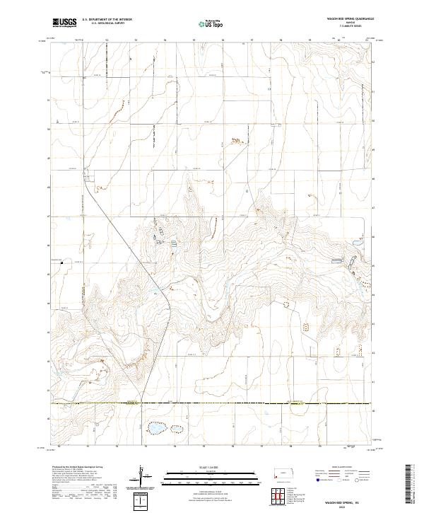
2022 Map of Wagon Bed Spring
USGS Topo · Published 2022About this map
Wagon Bed Spring marks a vital historical watering point on the Santa Fe Trail, situated along the valley of the Cimarron River. The landscape here is defined by the sharp contrast between the flat upland plains and the complex drainage patterns of the river breaks. Tracing through the high plains of Grant and Stevens Counties, the map shows a strictly organized grid of rural routes, including Co Rd 19 and Co Rd 20, which intersect the diagonal path of S Wagonbed Springs Rd. This intersection of modern agricultural road systems with ancient natural landmarks provides a clear look at how transportation has evolved in this corner of Kansas. Further north, the Zionville Cem stands as a quiet marker of the early families who settled this territory within t30s r37w.
Find a feature on this map
19 named features on this map. Tap any name to fly to it.
Don’t see what you’re looking for? This feature index may not catch every label — zoom into the map to look around manually.
Map Details
Editions of this 2022 Wagon Bed Spring Map
This is the sole edition of this map. No revisions or reprints were ever made.
Other maps of this area

1891 · Larned
USGS Topo · 1:125,000

1900 · Lakin
USGS Topo · 1:125,000

1944 · Moscow
USGS Topo · 1:62,500

1945 · Moscow
USGS Topo · 1:62,500

1955 · Dodge City
USGS Topo · 1:250,000

1958 · Dodge City
USGS Topo · 1:250,000

1959 · Dodge City
USGS Topo · 1:250,000

1959 · Ulysses
USGS Topo · 1:24,000
1959 · Ulysses SW
USGS Topo · 1:24,000

1959 · Hickok
USGS Topo · 1:24,000