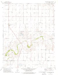
1974 Map of Wagon Bed Spring
USGS Topo · Published 1976About this map
Wagon Bed Spring serves as a historic focal point on this landscape, marking a vital water source along the Old Santa Fe Trail. The terrain is defined by the winding course of the Cimarron River, which cuts through the townships of Sullivan and Lincoln. By the mid-1970s, the area reflects a transition toward energy and industrial activity, evidenced by numerous Gas Wells, an Oil Well, and a large Compressor Station. Local heritage is anchored by the Zionville Cem in the west and a designated Roadside Park near the river. The map also captures the intersection of Grant and Stevens County lines, showing the survey's reach into Harmony and Moscow townships during a period of active natural resource extraction.
Find a feature on this map
16 named features on this map. Tap any name to fly to it.
Don’t see what you’re looking for? This feature index may not catch every label — zoom into the map to look around manually.
Map Details
Editions of this 1974 Wagon Bed Spring Map
This is the sole edition of this map. No revisions or reprints were ever made.
Other maps of this area

1891 · Larned
USGS Topo · 1:125,000

1900 · Lakin
USGS Topo · 1:125,000

1944 · Moscow
USGS Topo · 1:62,500

1945 · Moscow
USGS Topo · 1:62,500

1955 · Dodge City
USGS Topo · 1:250,000

1958 · Dodge City
USGS Topo · 1:250,000

1959 · Dodge City
USGS Topo · 1:250,000

1959 · Ulysses
USGS Topo · 1:24,000
1959 · Ulysses SW
USGS Topo · 1:24,000

1959 · Hickok
USGS Topo · 1:24,000