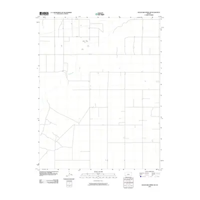
2010 Map of Wagon Bed Spring SW
USGS Topo · Published 2010About this map
The Cimarron River winds through the northern portion of this Stevens County landscape, defining the primary natural drainage in an otherwise highly structured agricultural area. The terrain is marked by a rigorous section-line road network, including corridors such as Rd CC, Rd 6, and Rd 7, which illustrate the persistent grid-based land management of the High Plains. While the river provides a rare break in the geometric pattern, the placement of isolated structures and homesteads near junctions like Rd Z and Rd 11 reflects the modern distribution of rural residency and farming operations. This survey from the first decade of the 21st century reveals a landscape primarily dedicated to large-scale agriculture, with the river remaining the central geological feature of the region.
Find a feature on this map
12 named features on this map. Tap any name to fly to it.
Don’t see what you’re looking for? This feature index may not catch every label — zoom into the map to look around manually.
Map Details
Editions of this 2010 Wagon Bed Spring SW Map
This is the sole edition of this map. No revisions or reprints were ever made.
Other maps of this area

1955 · Dodge City
USGS Topo · 1:250,000

1958 · Dodge City
USGS Topo · 1:250,000

1959 · Dodge City
USGS Topo · 1:250,000

1973 · Rolla NE
USGS Topo · 1:24,000

1974 · Hugoton
USGS Topo · 1:24,000

1974 · Feterita
USGS Topo · 1:24,000
1974 · Wagon Bed Spring NW
USGS Topo · 1:24,000

1974 · Shore Airport SE
USGS Topo · 1:24,000
1974 · Wagon Bed Spring SW
USGS Topo · 1:24,000
1974 · Wagon Bed Spring
USGS Topo · 1:24,000