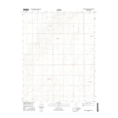
2015 Map of Wagon Bed Spring SW
USGS Topo · Published 2015About this map
The Cimarron River carves a winding path through the High Plains of Southwest Kansas, defining the topographic character of this Stevens County survey. In this landscape of expansive section lines and rolling prairie, the river's channel is the primary natural landmark, weaving between the borders of t31s r38w and t31s r37w. The human imprint is defined by a rigorous grid of section roads, including Rd Aa, Rd Z, and Rd X, which facilitate access across the agricultural townships. The elevation contours reveal the subtle drainage patterns feeding into the Cimarron, providing a snapshot of the region's hydrology and land-use management as it existed in the early 21st century.
Find a feature on this map
20 named features on this map. Tap any name to fly to it.
Don’t see what you’re looking for? This feature index may not catch every label — zoom into the map to look around manually.
Map Details
Editions of this 2015 Wagon Bed Spring SW Map
This is the sole edition of this map. No revisions or reprints were ever made.
Other maps of this area

1955 · Dodge City
USGS Topo · 1:250,000

1958 · Dodge City
USGS Topo · 1:250,000

1959 · Dodge City
USGS Topo · 1:250,000

1973 · Rolla NE
USGS Topo · 1:24,000

1974 · Hugoton
USGS Topo · 1:24,000

1974 · Feterita
USGS Topo · 1:24,000
1974 · Wagon Bed Spring NW
USGS Topo · 1:24,000

1974 · Shore Airport SE
USGS Topo · 1:24,000
1974 · Wagon Bed Spring SW
USGS Topo · 1:24,000
1974 · Wagon Bed Spring
USGS Topo · 1:24,000