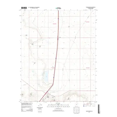
2013 Map of Wagon Mound
USGS Topo · Published 2013About this map
The village of Wagon Mound serves as the focal point of this Mora County landscape, situated where the historic Santa Fe Trl intersects the high plains. The map reveals a region defined by its water sources, including Salt Lake, Berlier Reservoir, and numerous named springs such as Coral Spring and Santa Clara Springs. These features were vital for the early ranching and travel networks that crossed this portion of New Mexico. Small settlements like Levy, Julian, and Daniels are documented alongside local landmarks like the S & S Ranch Airport. The topography is punctuated by prominent formations such as The Wagon Mound, Apache Hill, and Jarosa Mesa. Genealogists will find notable value in the location of several burial grounds, including Hillside Cem, Mtn View Cem, and Santa Clara Cem, which anchor the history of these remote communities to the land.
Find a feature on this map
33 named features on this map. Tap any name to fly to it.
Don’t see what you’re looking for? This feature index may not catch every label — zoom into the map to look around manually.
Map Details
Editions of this 2013 Wagon Mound Map
This is the sole edition of this map. No revisions or reprints were ever made.
Other maps of this area

1892 · Watrous
USGS Topo · 1:125,000

1894 · Watrous
USGS Topo · 1:125,000

1954 · Santa Fe
USGS Topo · 1:250,000

1954 · Raton
USGS Topo · 1:250,000

1958 · Raton
USGS Topo · 1:250,000

1958 · Santa Fe
USGS Topo · 1:250,000

1964 · Stony Lake
USGS Topo · 1:24,000

1964 · Wagon Mound
USGS Topo · 1:24,000

1964 · Alto De Hormiga
USGS Topo · 1:24,000

1964 · Mogote Hills
USGS Topo · 1:24,000