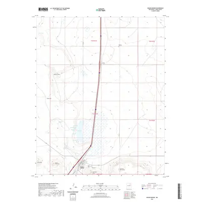
2020 Map of Wagon Mound
USGS Topo · Published 2020About this map
The landmark geologic formation known as The Wagon Mound rises above the plains of Mora County, serving as the namesake for the town of Wagon Mound below. This survey captures the intersection of natural hydrology and human settlement, centered around the seasonal Salt Lake and its surrounding network of water sources, including Big Spring, South Spring, and Coral Spring. The landscape transitions from the flat expanses of Santa Clara Mesa and Jarosa Mesa to the drainage of Apache Canyon in the northwest. Local history is anchored by the presence of three distinct burial sites: Hillside Cem, Santa Clara Cem, and the more remote Mountain View Cem to the north near the settlement of Levy. The detailed street grid of Wagon Mound reveals a town layout built along the railroad, with named thoroughfares like Wood Ave, Railroad Ave, and Fitch St defining the community's core.
Find a feature on this map
33 named features on this map. Tap any name to fly to it.
Don’t see what you’re looking for? This feature index may not catch every label — zoom into the map to look around manually.
Map Details
Editions of this 2020 Wagon Mound Map
This is the sole edition of this map. No revisions or reprints were ever made.
Other maps of this area

1892 · Watrous
USGS Topo · 1:125,000

1894 · Watrous
USGS Topo · 1:125,000

1954 · Santa Fe
USGS Topo · 1:250,000

1954 · Raton
USGS Topo · 1:250,000

1958 · Raton
USGS Topo · 1:250,000

1958 · Santa Fe
USGS Topo · 1:250,000

1964 · Stony Lake
USGS Topo · 1:24,000

1964 · Wagon Mound
USGS Topo · 1:24,000

1964 · Alto De Hormiga
USGS Topo · 1:24,000

1964 · Mogote Hills
USGS Topo · 1:24,000