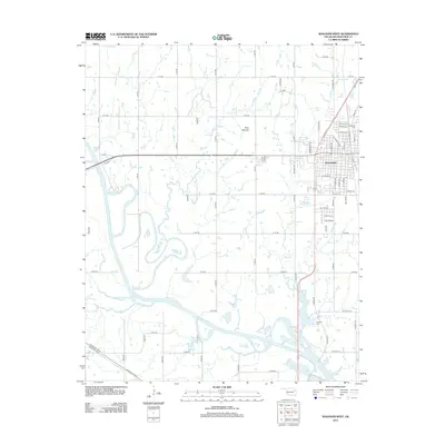
2012 Map of Wagoner West
USGS Topo · Published 2012About this map
The western edges of Wagoner meet the meandering path of the Verdigris River in this 2012 survey of eastern Oklahoma. The city street grid, featuring local routes like N Main St and SE 15th St, transitions into a landscape of creek systems and topographic rises. Notable features such as Blue Mound stand out against the drainage patterns of Billy Cr, Strawberry Cr, and Coal Cr, which feed the river valley. Genealogists will find the locations of Elmwood Cem and Grayson Cem well-documented in relation to the town's expansion. The southern portion of the map is defined by the heavy infrastructure of the Muskogee Tpke E and Muskogee Tpke W, highlighting the region's connectivity between Wagoner and larger municipal centers to the south.
Find a feature on this map
68 named features on this map. Tap any name to fly to it.
Don’t see what you’re looking for? This feature index may not catch every label — zoom into the map to look around manually.
Map Details
Editions of this 2012 Wagoner West Map
This is the sole edition of this map. No revisions or reprints were ever made.
Other maps of this area

1896 · Okmulgee
USGS Topo · 1:125,000

1896 · Pryor
USGS Topo · 1:125,000

1900 · Okmulgee
USGS Topo · 1:125,000

1901 · Muscogee
USGS Topo · 1:125,000

1901 · Claremore
USGS Topo · 1:125,000

1901 · Pryor
USGS Topo · 1:125,000

1905 · Muscogee
USGS Topo · 1:125,000

1914 · Claremore
USGS Topo · 1:125,000

1916 · Claremore
USGS Topo · 1:125,000

1946 · Fort Smith
USGS Topo · 1:250,000