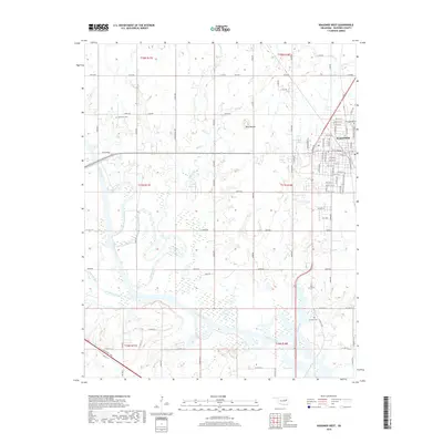
2018 Map of Wagoner West
USGS Topo · Published 2018About this map
The Wagoner municipal area and its western rural hinterlands are defined by the convergence of several major water systems, including the southward-flowing Coal Creek and Billy Creek as they approach the Verdigris River. This 2018 survey reveals a landscape of high prairie and bottomlands, punctuated by the distinct elevation of Blue Mound. While the city grid of Wagoner dominates the eastern edge of the map, the surrounding countryside preserves important markers of local history and family lineages. Genealogists and historians will find significant value in the documentation of local burial sites, such as Sandtown Cem, Elmwood Cem, and Grayson Cem. The persistence of agricultural and educational landmarks is further noted by Star School Rd, providing a trace of the rural infrastructure that once supported the farming communities west of the city.
Find a feature on this map
94 named features on this map. Tap any name to fly to it.
Don’t see what you’re looking for? This feature index may not catch every label — zoom into the map to look around manually.
Map Details
Editions of this 2018 Wagoner West Map
This is the sole edition of this map. No revisions or reprints were ever made.
Other maps of this area

1896 · Okmulgee
USGS Topo · 1:125,000

1896 · Pryor
USGS Topo · 1:125,000

1900 · Okmulgee
USGS Topo · 1:125,000

1901 · Muscogee
USGS Topo · 1:125,000

1901 · Claremore
USGS Topo · 1:125,000

1901 · Pryor
USGS Topo · 1:125,000

1905 · Muscogee
USGS Topo · 1:125,000

1914 · Claremore
USGS Topo · 1:125,000

1916 · Claremore
USGS Topo · 1:125,000

1946 · Fort Smith
USGS Topo · 1:250,000