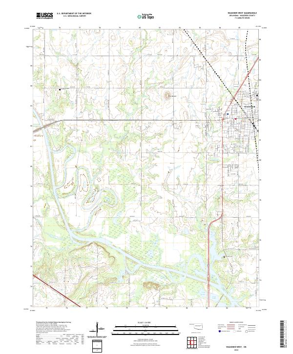
2022 Map of Wagoner West
USGS Topo · Published 2022About this map
Wagoner serves as a central hub on this landscape, defined by its street grid and the active rail lines of the Union Pacific. The terrain to the west is characterized by the meandering path of the Verdigris River and its various tributaries, including Coal Cr and Billy Creek. These watercourses flow through a region where agricultural land meets significant riparian features like Vans Lake and the 037018 Reservoir.
Find a feature on this map
86 named features on this map. Tap any name to fly to it.
Don’t see what you’re looking for? This feature index may not catch every label — zoom into the map to look around manually.
Map Details
Editions of this 2022 Wagoner West Map
This is the sole edition of this map. No revisions or reprints were ever made.
Other maps of this area

1896 · Okmulgee
USGS Topo · 1:125,000

1896 · Pryor
USGS Topo · 1:125,000

1900 · Okmulgee
USGS Topo · 1:125,000

1901 · Muscogee
USGS Topo · 1:125,000

1901 · Claremore
USGS Topo · 1:125,000

1901 · Pryor
USGS Topo · 1:125,000

1905 · Muscogee
USGS Topo · 1:125,000

1914 · Claremore
USGS Topo · 1:125,000

1916 · Claremore
USGS Topo · 1:125,000

1946 · Fort Smith
USGS Topo · 1:250,000