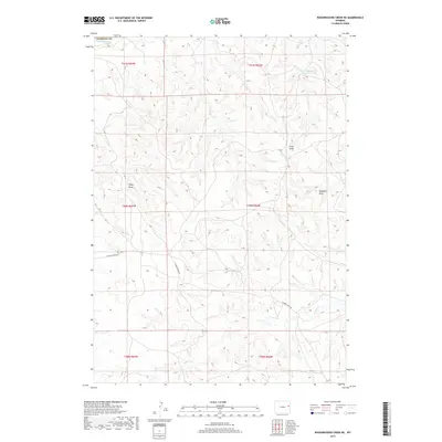
2017 Map of Wagonhound Creek NE
USGS Topo · Published 2017About this map
The Cheyenne River cuts across the northwest corner of this 2017 survey, defining a drainage system that shapes the terrain of Weston County. This high-plains landscape is characterized by a series of distinct drainage basins and intermittent water sources, where the land is carved into named features such as Piney Draw, Fred Draw, and Windmill Draw. These names, along with the Fred Number 1 Reservoir, suggest a history of ranching and land use where every available water source was a critical resource for the local economy.
Find a feature on this map
15 named features on this map. Tap any name to fly to it.
Don’t see what you’re looking for? This feature index may not catch every label — zoom into the map to look around manually.
Map Details
Editions of this 2017 Wagonhound Creek NE Map
This is the sole edition of this map. No revisions or reprints were ever made.
Other maps of this area

1955 · Newcastle
USGS Topo · 1:250,000

1958 · Newcastle
USGS Topo · 1:250,000

1979 · Newcastle
USGS Topo · 1:100,000

1981 · Calf Draw
USGS Topo · 1:24,000
1981 · Wagonhound Creek
USGS Topo · 1:24,000

1981 · Pinnacle Rocks
USGS Topo · 1:24,000

1981 · Dixon Ranch
USGS Topo · 1:24,000

1981 · Garland Draw
USGS Topo · 1:24,000

1981 · Wagonhound Creek NE
USGS Topo · 1:24,000

1981 · Lance Creek
USGS Topo · 1:100,000