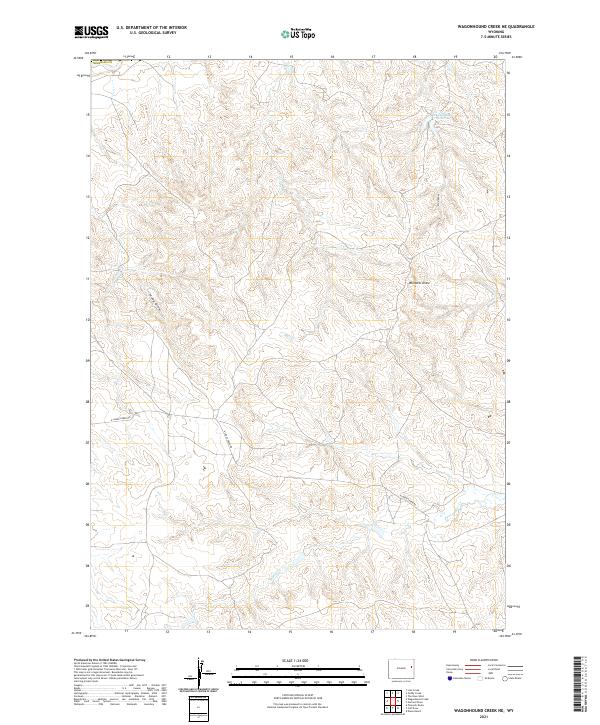
2021 Map of Wagonhound Creek NE
USGS Topo · Published 2021About this map
Fred Number 1 Reservoir and the drainage network of northern Niobrara County define this landscape of the High Plains. This 2021 topographic survey illustrates the intersection of rural land management and natural topography, where dry watercourses like Fred Draw, Windmill Draw, and Piney Draw dictate the local geography. The map shows the sparsely populated character of the region, anchored by the winding path of N Lance Creek Rd as it traverses the terrain. Intermittent streams including Owl Cr, Snyder Cr, and Snider Cr represent the seasonal hydrology essential to ranching and land use in this corner of Wyoming. The detailed contour work provided by the U.S. Geological Survey highlights the subtle elevation shifts across the several townships surveyed here.
Find a feature on this map
15 named features on this map. Tap any name to fly to it.
Don’t see what you’re looking for? This feature index may not catch every label — zoom into the map to look around manually.
Map Details
Editions of this 2021 Wagonhound Creek NE Map
This is the sole edition of this map. No revisions or reprints were ever made.
Other maps of this area

1955 · Newcastle
USGS Topo · 1:250,000

1958 · Newcastle
USGS Topo · 1:250,000

1979 · Newcastle
USGS Topo · 1:100,000

1981 · Calf Draw
USGS Topo · 1:24,000
1981 · Wagonhound Creek
USGS Topo · 1:24,000

1981 · Pinnacle Rocks
USGS Topo · 1:24,000

1981 · Dixon Ranch
USGS Topo · 1:24,000

1981 · Garland Draw
USGS Topo · 1:24,000

1981 · Wagonhound Creek NE
USGS Topo · 1:24,000

1981 · Lance Creek
USGS Topo · 1:100,000