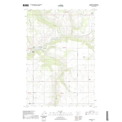
2020 Map of Wahkiacus
USGS Topo · Published 2020About this map
Wahkiacus sits at the confluence of the Klickitat River and the winding Swale Creek, defining a landscape where narrow canyons meet high agricultural plateaus. The topography is dominated by the dramatic descent of Wahkiacus Canyon and Swale Canyon, through which the Klickitat State Park Trail follows the former rail grade along the river's edge. To the south, the terrain opens into the elevated flats of High Prairie, while the northeast corner reaches toward the Crofton Prairie. This 2020 survey illustrates a sparsely populated region of Klickitat County, where development is concentrated along remote corridors like Wahkiacus Heights Rd and Finn Ridge Rd. The map also captures several distinct water sources, including Maddock Springs and the uniquely named Bluehse Yurt Spr, which speak to the area's rural water management and contemporary land use.
Find a feature on this map
44 named features on this map. Tap any name to fly to it.
Don’t see what you’re looking for? This feature index may not catch every label — zoom into the map to look around manually.
Map Details
Editions of this 2020 Wahkiacus Map
This is the sole edition of this map. No revisions or reprints were ever made.
Other maps of this area

1934 · The Dalles
USGS Topo · 1:125,000

1953 · The Dalles
USGS Topo · 1:250,000

1956 · The Dalles
USGS Topo · 1:250,000

1957 · The Dalles
USGS Topo · 1:250,000

1957 · Klickitat
USGS Topo · 1:62,500

1957 · Goldendale
USGS Topo · 1:62,500

1957 · The Dalles
USGS Topo · 1:62,500

1957 · Wishram
USGS Topo · 1:62,500

1974 · Stacker Butte
USGS Topo · 1:24,000

1974 · The Dalles North
USGS Topo · 1:24,000