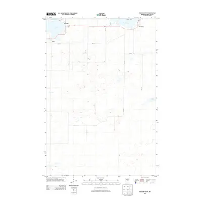
2013 Map of Wahkon South
USGS Topo · Published 2013About this map
Wahkon, Bayview, and Cove border the southern shores of Mille Lacs Lake in this 2013 topographic study of central Minnesota. The landscape is defined by the immediate transition from the massive lake to a series of smaller, secluded water bodies and wetlands, such as Ernst Pool and Korsness Pool. State Highway MN-27 serves as the primary east-west artery, connecting these lakeside communities and passing just south of Mulybys Island. Local history is anchored by features like Foster Cem near the northern shore, providing a point of reference for genealogists. The grid of rural roads, including 90th Ave and 385th St, illustrates the low-density residential development and agricultural land typical of Mille Lacs County in the early 21st century.
Find a feature on this map
23 named features on this map. Tap any name to fly to it.
Don’t see what you’re looking for? This feature index may not catch every label — zoom into the map to look around manually.
Map Details
Editions of this 2013 Wahkon South Map
This is the sole edition of this map. No revisions or reprints were ever made.
Other maps of this area

1953 · Duluth
USGS Topo · 1:250,000

1953 · Stillwater
USGS Topo · 1:250,000

1955 · Stillwater
USGS Topo · 1:250,000

1958 · Stillwater
USGS Topo · 1:250,000

1958 · Duluth
USGS Topo · 1:250,000

1965 · Stillwater
USGS Topo · 1:250,000

1968 · Onamia NW
USGS Topo · 1:24,000

1968 · Milaca NE
USGS Topo · 1:24,000

1968 · Ann Lake
USGS Topo · 1:24,000

1968 · Onamia
USGS Topo · 1:24,000