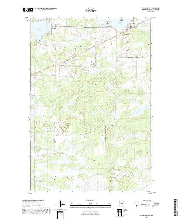
2022 Map of Wahkon South
USGS Topo · Published 2022About this map
Wahkon and the surrounding southern shores of Mille Lacs Lake define this portion of the county, where the shoreline alternates between developed bays and protected wetlands. The map illustrates the conversion of historic transit corridors into modern recreational infrastructure, notably the Soo Line South: Mille Lacs Trl which follows the old rail alignment through Bayview toward the lakefront. Local heritage is grounded in sites like the Foster Cem, while the landscape further south transitions into the more secluded waters of Ernst Pool and the meandering path of Black Brook. Settlement remains concentrated near the water at Cove and Cove Bay, where a dense network of local roads such as Eyota Way and Winona Way serves the lakeside community. This contemporary survey by the U.S. Geological Survey provides a precise view of how legacy rail paths and residential clusters interact with the extensive marshlands and bays of this iconic lake region.
Find a feature on this map
38 named features on this map. Tap any name to fly to it.
Don’t see what you’re looking for? This feature index may not catch every label — zoom into the map to look around manually.
Map Details
Editions of this 2022 Wahkon South Map
This is the sole edition of this map. No revisions or reprints were ever made.
Other maps of this area

1953 · Duluth
USGS Topo · 1:250,000

1953 · Stillwater
USGS Topo · 1:250,000

1955 · Stillwater
USGS Topo · 1:250,000

1958 · Stillwater
USGS Topo · 1:250,000

1958 · Duluth
USGS Topo · 1:250,000

1965 · Stillwater
USGS Topo · 1:250,000

1968 · Onamia NW
USGS Topo · 1:24,000

1968 · Milaca NE
USGS Topo · 1:24,000

1968 · Ann Lake
USGS Topo · 1:24,000

1968 · Onamia
USGS Topo · 1:24,000