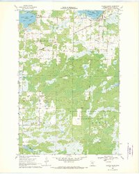
1968 Map of Wahkon South
USGS Topo · Published 1970About this map
Mille Lacs Lake and its southern shorelines define this 1968 landscape, where the settlements of Wahkon, Bayview, and Cove serve as focal points for the region's lakeside activity. The map reveals a transition from the structured street grid of Wahkon on Wahkon Bay to the expansive wetlands and marshes of the Mille Lacs State Wildlife Management Area. Historical transportation is evident through the path of the Soo Line and a prominent Old Railroad Grade that cuts through Isle Harbor and Lewis.
Find a feature on this map
24 named features on this map. Tap any name to fly to it.
Don’t see what you’re looking for? This feature index may not catch every label — zoom into the map to look around manually.
Map Details
Editions of this 1968 Wahkon South Map
This is the sole edition of this map. No revisions or reprints were ever made.
Other maps of this area

1953 · Duluth
USGS Topo · 1:250,000

1953 · Stillwater
USGS Topo · 1:250,000

1955 · Stillwater
USGS Topo · 1:250,000

1958 · Stillwater
USGS Topo · 1:250,000

1958 · Duluth
USGS Topo · 1:250,000

1965 · Stillwater
USGS Topo · 1:250,000

1968 · Onamia NW
USGS Topo · 1:24,000

1968 · Milaca NE
USGS Topo · 1:24,000

1968 · Ann Lake
USGS Topo · 1:24,000

1968 · Onamia
USGS Topo · 1:24,000