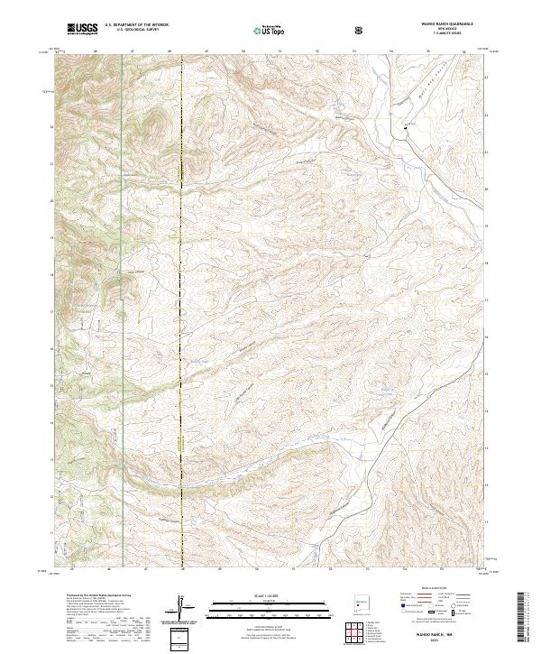
2023 Map of Wahoo Ranch
USGS Topo · Published 2023About this map
Wahoo Ranch and the small settlement at Knisely sit within a high-elevation landscape defined by the drainage networks of the Gila National Forest. This modern survey documents the rugged canyon country where the Catron and Socorro County line intersects deep-cut terrain like Wahoo Canyon and Knisely Canyon. Water management is central to the land's history here, evidenced by a series of engineered water sources including Clay Tank, Knisely Tank, and Badger Hole Tank scattered across the township lines. The cattle-ranching legacy of the region is further visible in the presence of Bull-Pasture Tank and the isolated Dusty Cem near Alamosa Creek. Navigability follows the contours of the land, with Silver Creek and the Forest Service roads like Forest 478 Rd providing the primary access through this complex system of canyons and ridges.
Find a feature on this map
29 named features on this map. Tap any name to fly to it.
Don’t see what you’re looking for? This feature index may not catch every label — zoom into the map to look around manually.
Map Details
Editions of this 2023 Wahoo Ranch Map
This is the sole edition of this map. No revisions or reprints were ever made.
Other maps of this area

1949 · Lookout Mountain
USGS Topo · 1:62,500

1954 · Tularosa
USGS Topo · 1:250,000

1958 · Tularosa
USGS Topo · 1:250,000

1964 · Welty Hill
USGS Topo · 1:24,000

1964 · Montoya Butte
USGS Topo · 1:24,000

1965 · Iron Mountain
USGS Topo · 1:24,000

1965 · Jaralosa Mountain
USGS Topo · 1:24,000

1965 · Dusty
USGS Topo · 1:24,000

1965 · Wahoo Peak
USGS Topo · 1:24,000

1979 · Truth or Consequences
USGS Topo · 1:100,000