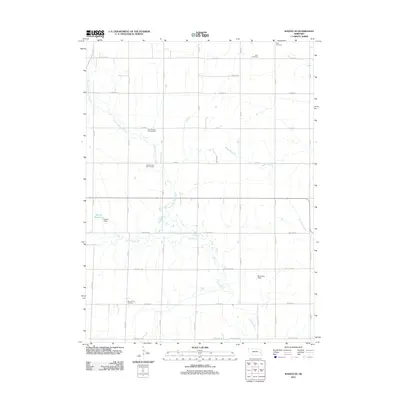
2011 Map of Wahoo SE
USGS Topo · Published 2011About this map
New Pleasant Hill Cemetery and Old Pleasant Hill Cemetery serve as central landmarks in this agricultural landscape of northern Lancaster County. The terrain is defined by the intricate drainage of Rock Creek and its many tributaries, including North Fork Rock Creek and the Robinson Branch. A network of section-line roads such as Ashland Rd and Agnew Rd grid the countryside, connecting scattered farmsteads and rural sites like Bornmann Field. The map reveals the local significance of water management through features like Martin Reservoir, held by Martin Dam, which breaks the otherwise consistent stream flow. Along the southern edge, Little Salt Creek and Millville Creek wind through the prairie soils, while the Free Church Cemetery and Zion Cemetery provide important points of reference for genealogists tracking early families of the Wahoo area.
Find a feature on this map
38 named features on this map. Tap any name to fly to it.
Don’t see what you’re looking for? This feature index may not catch every label — zoom into the map to look around manually.
Map Details
Editions of this 2011 Wahoo SE Map
This is the sole edition of this map. No revisions or reprints were ever made.
Other maps of this area

1893 · Fremont
USGS Topo · 1:125,000

1896 · Fremont
USGS Topo · 1:125,000

1897 · Lincoln
USGS Topo · 1:125,000

1899 · Wahoo
USGS Topo · 1:125,000

1903 · Weeping Water
USGS Topo · 1:125,000

1929 · Weeping Water
USGS Topo · 1:125,000

1955 · Fremont
USGS Topo · 1:250,000

1955 · Lincoln
USGS Topo · 1:250,000

1957 · Fremont
USGS Topo · 1:250,000

1957 · Lincoln
USGS Topo · 1:250,000