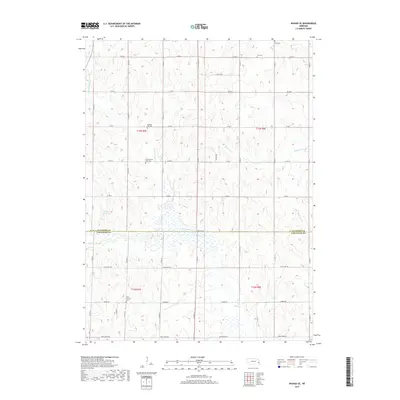
2017 Map of Wahoo SE
USGS Topo · Published 2017About this map
The rolling agricultural divide between the Saunders and Lancaster County line is defined by a series of north-south drainage networks and local burial grounds. This rural landscape is heavily influenced by the upper reaches of N Fork Rock Cr and Little Salt Cr, which carve through the prairie terrain. Genealogy researchers will find significant value in the preservation of several rural burial sites, including the Old Pleasant Hill Cem and the Pleasant Hill Cem located near the center of the township. Further south, the Free Church and its accompanying Free Church Cem stand along Agnew Rd, representing the spiritual and social hubs of this farming community. The map also captures the local water management through features like the Martin Reservoir and the winding course of Mosquito Cr in the northeast.
Find a feature on this map
26 named features on this map. Tap any name to fly to it.
Don’t see what you’re looking for? This feature index may not catch every label — zoom into the map to look around manually.
Map Details
Editions of this 2017 Wahoo SE Map
This is the sole edition of this map. No revisions or reprints were ever made.
Other maps of this area

1893 · Fremont
USGS Topo · 1:125,000

1896 · Fremont
USGS Topo · 1:125,000

1897 · Lincoln
USGS Topo · 1:125,000

1899 · Wahoo
USGS Topo · 1:125,000

1903 · Weeping Water
USGS Topo · 1:125,000

1929 · Weeping Water
USGS Topo · 1:125,000

1955 · Fremont
USGS Topo · 1:250,000

1955 · Lincoln
USGS Topo · 1:250,000

1957 · Fremont
USGS Topo · 1:250,000

1957 · Lincoln
USGS Topo · 1:250,000