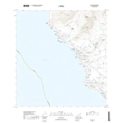
2017 Map of Waianae
USGS Topo · Published 2017About this map
Wai'anae and the surrounding leeward coast of O'ahu are defined by the dramatic meeting of steep volcanic ridges and the Pacific Ocean. This survey details a landscape where traditional geography intersects with modern development, from the depths of Mākaha Valley to the coastal settlements of Mā'ili and Nānākuli. Significant cultural and historical markers are preserved here, including the Sacred Hearts Cem and Waianae Protestant Cem, which anchor the community near the protected waters of Pōka'ī Bay.
Find a feature on this map
123 named features on this map. Tap any name to fly to it.
Don’t see what you’re looking for? This feature index may not catch every label — zoom into the map to look around manually.
Map Details
Editions of this 2017 Waianae Map
This is the sole edition of this map. No revisions or reprints were ever made.
Other maps of this area

1953 · Haleiwa
USGS Topo · 1:24,000

1953 · Schofield Barracks
USGS Topo · 1:24,000

1953 · Ewa
USGS Topo · 1:24,000

1954 · Oahu
USGS Topo · 1:250,000

1954 · Waianae
USGS Topo · 1:24,000

1954 · Kaena
USGS Topo · 1:24,000

1960 · Haleiwa
USGS Topo · 1:24,000

1960 · Schofield Barracks
USGS Topo · 1:24,000

1961 · Oahu
USGS Topo · 1:250,000
1962 · Ewa
USGS Topo · 1:24,000