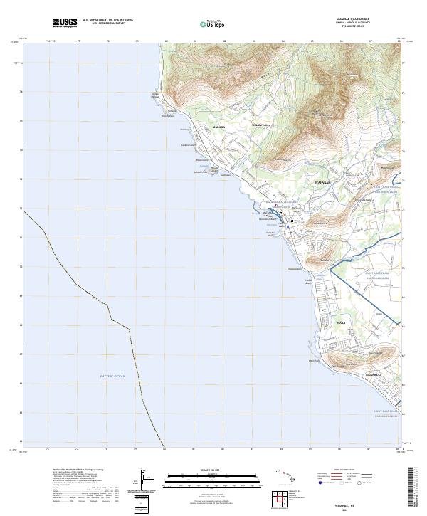
2024 Map of Waianae
USGS Topo · Published 2024About this map
Makaha and Wai‘anae anchor this modern coastal survey of western O‘ahu, where the residential valleys are framed by the dramatic heights of Kamaile‘unu Ridge and Pāhe‘ehe‘e Ridge. The landscape reveals a complex layering of land use, from the sacred and historical grounds of Sacred Heart Catholic Cem and Waianae Protestant Cem to the modern logistics of Joint Base Pearl Harbor-Hickam. Notable hydrological features like the Mikilua Flume and various seasonal drainages such as Mākaha Stream illustrate the essential management of water descending from the interior peaks to the coast.
Find a feature on this map
124 named features on this map. Tap any name to fly to it.
Don’t see what you’re looking for? This feature index may not catch every label — zoom into the map to look around manually.
Map Details
Editions of this 2024 Waianae Map
This is the sole edition of this map. No revisions or reprints were ever made.
Other maps of this area

1953 · Haleiwa
USGS Topo · 1:24,000

1953 · Schofield Barracks
USGS Topo · 1:24,000

1953 · Ewa
USGS Topo · 1:24,000

1954 · Oahu
USGS Topo · 1:250,000

1954 · Waianae
USGS Topo · 1:24,000

1954 · Kaena
USGS Topo · 1:24,000

1960 · Haleiwa
USGS Topo · 1:24,000

1960 · Schofield Barracks
USGS Topo · 1:24,000

1961 · Oahu
USGS Topo · 1:250,000
1962 · Ewa
USGS Topo · 1:24,000