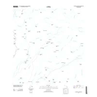
2013 Map of Waimea Canyon
USGS Topo · Published 2013About this map
Waimea Canyon dominates this Kauai landscape, where the confluence of the Waimea River and its many tributaries has carved deep into the volcanic terrain. High on the western rim, Kōke'e State Park provides access to viewpoints like the Waimea Canyon Lookout. The map reveals a history of remote utility and residency through various scattered locations such as Wiliwili Camp, Lonomea Camp, and Hipalau Camp. Water management is central to the area's development, evidenced by the Mauka Powerhouse and Kepani Reservoir. Numerous dramatic falls, including Waipo'o Falls and Wai'alae Falls, drop from ridges like Kaluahā'ula Ridge into the valleys below. The intricate drainage network of the Makaweli River and Olokele River in the south illustrates the complex watershed that defines this portion of the island.
Find a feature on this map
100 named features on this map. Tap any name to fly to it.
Don’t see what you’re looking for? This feature index may not catch every label — zoom into the map to look around manually.
Map Details
Editions of this 2013 Waimea Canyon Map
This is the sole edition of this map. No revisions or reprints were ever made.
Other maps of this area

1954 · Kauai
USGS Topo · 1:250,000

1963 · Kekaha
USGS Topo · 1:24,000

1963 · Hanapepe
USGS Topo · 1:24,000

1963 · Koloa
USGS Topo · 1:24,000

1963 · Hanalei
USGS Topo · 1:24,000

1965 · Waimea Canyon
USGS Topo · 1:24,000

1965 · Haena
USGS Topo · 1:24,000

1965 · Makaha Point
USGS Topo · 1:24,000

1965 · Waialeale
USGS Topo · 1:24,000

1967 · Kauai
USGS Topo · 1:250,000