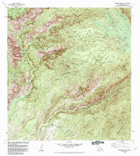
1983 Map of Waimea Canyon
USGS Topo · Published 1984About this map
Waimea Canyon State Park and the Na Pali-Kona Forest Reserve dominate the landscape of west-central Kauai in this early 1980s survey. The map reveals a complex network of water management and hydroelectric infrastructure, including the Kekaha Ditch, the Olokele Ditch, and the Mauna Powerhouse with its associated Penstock. These engineering works, carved into steep ridges like Ohulelua Ridge and Kahana Ridge, illustrate the intensive efforts to divert water from the high-elevation streams for lower-lying agricultural use.
Find a feature on this map
100 named features on this map. Tap any name to fly to it.
Don’t see what you’re looking for? This feature index may not catch every label — zoom into the map to look around manually.
Map Details
Editions of this 1983 Waimea Canyon Map
This is the sole edition of this map. No revisions or reprints were ever made.
Other maps of this area

1954 · Kauai
USGS Topo · 1:250,000

1963 · Kekaha
USGS Topo · 1:24,000

1963 · Hanapepe
USGS Topo · 1:24,000

1963 · Koloa
USGS Topo · 1:24,000

1963 · Hanalei
USGS Topo · 1:24,000

1965 · Waimea Canyon
USGS Topo · 1:24,000

1965 · Haena
USGS Topo · 1:24,000

1965 · Makaha Point
USGS Topo · 1:24,000

1965 · Waialeale
USGS Topo · 1:24,000

1967 · Kauai
USGS Topo · 1:250,000