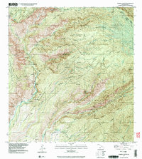
1991 Map of Waimea Canyon
USGS Topo · Published 2003About this map
Waimea Canyon State Park and the surrounding wilderness of western Kauai are meticulously documented in this late 20th-century survey. The landscape is defined by the deep incisions of the Waimea River and its numerous tributaries, including Mohihi Stream and Kawaikoi Stream, which create a complex network of ridges and valleys like Kohua Ridge and Wahane Valley. This era of management is characterized by a mix of recreation and resource protection, evidenced by the many remote outposts such as Lonernea Camp, Hipalau Camp, and the Waialae Cabin. Significant landmarks like Waipoo Falls and the Waimea Canyon Lookout highlight the area's geological drama, while the Mauka Powerhouse and various gaging stations indicate the active management of the island's water resources within the Na Pali-Kona Forest Reserve.
Find a feature on this map
44 named features on this map. Tap any name to fly to it.
Don’t see what you’re looking for? This feature index may not catch every label — zoom into the map to look around manually.
Map Details
Editions of this 1991 Waimea Canyon Map
This is the sole edition of this map. No revisions or reprints were ever made.
Other maps of this area

1954 · Kauai
USGS Topo · 1:250,000

1963 · Kekaha
USGS Topo · 1:24,000

1963 · Hanapepe
USGS Topo · 1:24,000

1963 · Koloa
USGS Topo · 1:24,000

1963 · Hanalei
USGS Topo · 1:24,000

1965 · Waimea Canyon
USGS Topo · 1:24,000

1965 · Haena
USGS Topo · 1:24,000

1965 · Makaha Point
USGS Topo · 1:24,000

1965 · Waialeale
USGS Topo · 1:24,000

1967 · Kauai
USGS Topo · 1:250,000