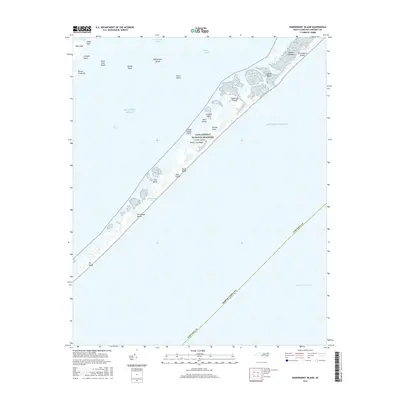
2016 Map of Wainwright Island
USGS Topo · Published 2016About this map
Cape Lookout National Seashore dominates this coastal survey, preserving a narrow ribbon of the Outer Banks as they stretch between the Atlantic Ocean and Core Sound. This environment is defined by shifting sands and isolated landforms like Portsmouth Island and the North Core Banks. The landscape is a complex network of shoals and small islands, including Harbor Island and the Pilontary Islands, which separate the sounds from the open sea. Inland, features like Merkle Hammock and the George Hills provide slight elevations in an otherwise low-lying maritime reach. The presence of Old House Beach and The Sands reflects the coastal processes that continuously reshape this portion of Carteret County.
Find a feature on this map
31 named features on this map. Tap any name to fly to it.
Don’t see what you’re looking for? This feature index may not catch every label — zoom into the map to look around manually.
Map Details
Editions of this 2016 Wainwright Island Map
This is the sole edition of this map. No revisions or reprints were ever made.
Other maps of this area

1948 · Portsmouth
USGS Topo · 1:24,000

1948 · North Bay
USGS Topo · 1:24,000

1949 · Atlantic
USGS Topo · 1:24,000

1949 · Styron Bay
USGS Topo · 1:24,000

1950 · Portsmouth
USGS Topo · 1:24,000

1950 · North Bay
USGS Topo · 1:24,000
1951 · Atlantic
USGS Topo · 1:24,000
1951 · Styron Bay
USGS Topo · 1:24,000

1953 · Rocky Mount
USGS Topo · 1:250,000

1953 · Beaufort
USGS Topo · 1:250,000