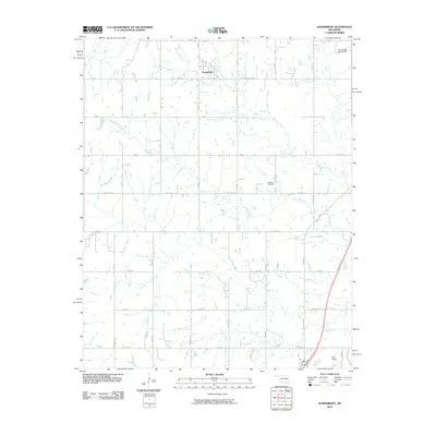
2010 Map of Wainwright
USGS Topo · Published 2010About this map
The small town of Wainwright serves as the central hub of this eastern Oklahoma landscape, where a dense grid of section-line roads like E 1010 Rd and Wainwright Rd provides access to the agricultural hinterlands. The terrain is defined by the winding paths of Anderson Creek and Wayside Creek, which drain the undulating rural acreage surrounding the settlement. To the southeast, the Koch Airport and a small collection of structures near the intersection of N 4220 Rd indicate the area's continued utility as a transportation and service corridor. Local heritage is preserved at the Middleton Cemetery, while the northern portion of the quadrangle shows the impact of water management through the Cane Creek Site 24 Dam. This survey illustrates the persistent rural character of the region, where family history and land ownership are tied to the distinct road networks and drainage basins.
Find a feature on this map
30 named features on this map. Tap any name to fly to it.
Don’t see what you’re looking for? This feature index may not catch every label — zoom into the map to look around manually.
Map Details
Editions of this 2010 Wainwright Map
This is the sole edition of this map. No revisions or reprints were ever made.
Other maps of this area

1896 · Okmulgee
USGS Topo · 1:125,000

1900 · Sansbois
USGS Topo · 1:125,000

1900 · Canadian
USGS Topo · 1:125,000

1900 · Okmulgee
USGS Topo · 1:125,000

1901 · Muscogee
USGS Topo · 1:125,000

1905 · Muscogee
USGS Topo · 1:125,000

1909 · Sans Bois
USGS Topo · 1:125,000

1911 · Sansbois
USGS Topo · 1:125,000

1946 · Fort Smith
USGS Topo · 1:250,000

1948 · Keefeton
USGS Topo · 1:62,500