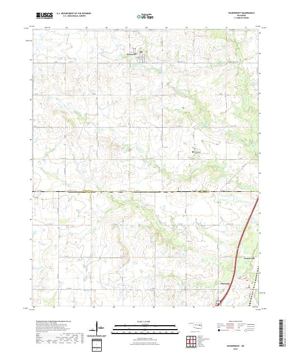
2022 Map of Wainwright
USGS Topo · Published 2022About this map
Wainwright and Rentiesville anchor the landscape of this eastern Oklahoma survey, which straddles the rural border between Muskogee and McIntosh counties. The terrain is defined by the winding paths of Anderson Creek and Wayside Creek, creating a network of drainage that feeds into the nearby Elk Creek. A grid of section roads like Mitchells Road and Wainwright Road provides structure to the agricultural surroundings, connecting the scattered homesteads and small settlements. A notable cultural landmark is Middleton Chapel Cemetery, situated in the eastern portion of the quadrangle. This 2022 edition reflects the enduring rural character of the region, where historical boundaries like the County Line Road still dictate the local geography and transport patterns.
Find a feature on this map
28 named features on this map. Tap any name to fly to it.
Don’t see what you’re looking for? This feature index may not catch every label — zoom into the map to look around manually.
Map Details
Editions of this 2022 Wainwright Map
This is the sole edition of this map. No revisions or reprints were ever made.
Other maps of this area

1896 · Okmulgee
USGS Topo · 1:125,000

1900 · Sansbois
USGS Topo · 1:125,000

1900 · Canadian
USGS Topo · 1:125,000

1900 · Okmulgee
USGS Topo · 1:125,000

1901 · Muscogee
USGS Topo · 1:125,000

1905 · Muscogee
USGS Topo · 1:125,000

1909 · Sans Bois
USGS Topo · 1:125,000

1911 · Sansbois
USGS Topo · 1:125,000

1946 · Fort Smith
USGS Topo · 1:250,000

1948 · Keefeton
USGS Topo · 1:62,500