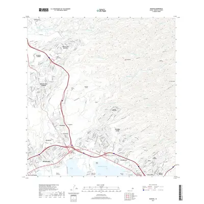
2017 Map of Waipahu
USGS Topo · Published 2017About this map
Pearl Harbor's complex shoreline, featuring Middle Loch and East Loch, serves as the southern anchor for this detailed topography of southern O‘ahu. The landscape transitions from the urban density of Pearl City, Waipahu, and Aiea to the deep, parallel incisions of Panakauahi Gulch and Punanani Gulch. These natural drainages dictated the development patterns of upland residential communities like Pacific Palisades and Mililani Town, which sit atop the plateaus between gulches.
Find a feature on this map
68 named features on this map. Tap any name to fly to it.
Don’t see what you’re looking for? This feature index may not catch every label — zoom into the map to look around manually.
Map Details
Editions of this 2017 Waipahu Map
This is the sole edition of this map. No revisions or reprints were ever made.
Other maps of this area

1953 · Haleiwa
USGS Topo · 1:24,000

1953 · Schofield Barracks
USGS Topo · 1:24,000

1953 · Honolulu
USGS Topo · 1:24,000

1953 · Ewa
USGS Topo · 1:24,000

1953 · Puuloa
USGS Topo · 1:24,000

1953 · Hauula
USGS Topo · 1:24,000

1954 · Oahu
USGS Topo · 1:250,000

1954 · Kahana
USGS Topo · 1:24,000

1954 · Kaneohe
USGS Topo · 1:24,000

1954 · Waipahu
USGS Topo · 1:24,000