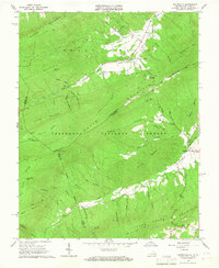
1965 Map of Waiteville
USGS Topo · Published 1967About this map
Waiteville sits in the high mountain valley of Potts Creek, a central community in this 1965 survey along the Virginia and West Virginia border. The landscape is defined by the heavy ridges of Peters Mountain and Potts Mountain, which corridor the early transportation routes through the Jefferson National Forest. This era shows the transition of mountain infrastructure, specifically an Old Railroad Grade running through Ray Siding, signaling the legacy of timber or mineral extraction in the steep hollows. Small settlements like Maggie and Captain mark the eastern and southern reaches of the quadrangle, connected by winding creek-side roads and trails. For those tracking outdoor history, the Appalachian Trail is documented as it traverses the high ground near Lone Pine Peak, while local sites like New Zion Union Ch and Taylor Cem provide essential anchor points for family history and genealogy.
Find a feature on this map
60 named features on this map. Tap any name to fly to it.
Don’t see what you’re looking for? This feature index may not catch every label — zoom into the map to look around manually.
Map Details
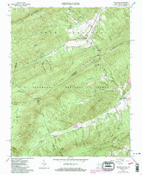
Editions of this 1965 Waiteville Map
2 editions found
Other maps of this area

1887 · Hinton
USGS Topo · 1:125,000

1887 · Lewisburg
USGS Topo · 1:125,000

1890 · Dublin
USGS Topo · 1:125,000

1890 · Christiansburg
USGS Topo · 1:125,000

1891 · Lewisburg
USGS Topo · 1:125,000

1891 · Dublin
USGS Topo · 1:125,000

1892 · Hinton
USGS Topo · 1:125,000

1921 · Alderson
USGS Topo · 1:48,000

1921 · Ronceverte
USGS Topo · 1:48,000

1923 · Ronceverte
USGS Topo · 1:62,500