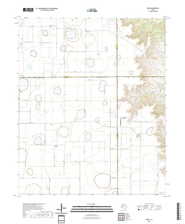
2022 Map of Wake
USGS Topo · Published 2022About this map
Wake serves as the primary settlement hub for this agricultural region of West Texas, situated near the intersection of several local routes. The landscape is defined by the sharp transition between the level, farm-dominated plains to the west and the deeply etched drainage systems of Rustler Cr and Grapevine Cr to the east. This drainage network marks the edge of the Caprock, where the terrain breaks away into a complex series of canyons and draws. Agricultural life is evidenced by the presence of the Gardner Farm Airport and a grid of secondary roads such as FM 28 and FM 1958. For those researching local heritage, the Antelope Cem in the northern portion of the map remains a significant site for family history and genealogy.
Find a feature on this map
42 named features on this map. Tap any name to fly to it.
Don’t see what you’re looking for? This feature index may not catch every label — zoom into the map to look around manually.
Map Details
Editions of this 2022 Wake Map
This is the sole edition of this map. No revisions or reprints were ever made.
Other maps of this area

1954 · Lubbock
USGS Topo · 1:250,000

1965 · Wake
USGS Topo · 1:24,000

1965 · Boothe
USGS Topo · 1:24,000

1966 · Crosbyton
USGS Topo · 1:24,000

1966 · Mount Blanco
USGS Topo · 1:24,000

1966 · McAdoo
USGS Topo · 1:24,000

1967 · Haystack Mountain
USGS Topo · 1:24,000

1968 · Mac Bain
USGS Topo · 1:24,000

1968 · Rustler Camp
USGS Topo · 1:24,000
1968 · Dougherty
USGS Topo · 1:24,000