
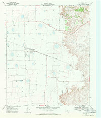
1965 Map of Wake
USGS Topo · Published 1968About this map
The small community of Wake serves as a focal point in this 1960s survey of the High Plains landscape, where the transition between flat tableland and the eroded breaks is clearly defined. The terrain is marked by numerous depression features and Well sites, reflecting a landscape heavily dependent on groundwater management. In the northern reaches, the Antelope Cem stands as a quiet marker of early settlement history, while the Plains Windmill signifies the vital infrastructure required for ranching in this arid region. To the east, the topography shifts dramatically as the land drops away into the drainage of Rustler Creek, revealing the intricate canyon systems common along the edge of the Caprock. This map also preserves the intersecting boundaries of four counties—Floyd, Crosby, Motley, and Dickens—mapping a complex administrative junction.
Find a feature on this map
9 named features on this map. Tap any name to fly to it.
Don’t see what you’re looking for? This feature index may not catch every label — zoom into the map to look around manually.
Map Details
Editions of this 1965 Wake Map
This is the sole edition of this map. No revisions or reprints were ever made.
Other maps of this area

1954 · Lubbock
USGS Topo · 1:250,000

1965 · Boothe
USGS Topo · 1:24,000

1966 · Crosbyton
USGS Topo · 1:24,000

1966 · Mount Blanco
USGS Topo · 1:24,000

1966 · McAdoo
USGS Topo · 1:24,000

1967 · Haystack Mountain
USGS Topo · 1:24,000

1968 · Mac Bain
USGS Topo · 1:24,000

1968 · Rustler Camp
USGS Topo · 1:24,000
1968 · Dougherty
USGS Topo · 1:24,000

1985 · Dickens
USGS Topo · 1:100,000