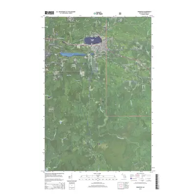
2014 Map of Wakefield
USGS Topo · Published 2014About this map
Sunday Lake sits at the heart of this landscape, anchoring a corridor of historical settlements that grew alongside the mining and timber interests of the Upper Peninsula. The city of Wakefield is flanked by several distinct communities, including Verona, Ramsay, and Plymouth, each reflecting the region’s development during the early 21st century. The map reveals the deep influence of resource extraction through the naming of local infrastructure, such as Plymouth Mine Rd and N Chicago Mine Rd, while the Lakeside Cem near the lake's southern shore provides a point of interest for genealogists tracing local families.
Find a feature on this map
50 named features on this map. Tap any name to fly to it.
Don’t see what you’re looking for? This feature index may not catch every label — zoom into the map to look around manually.
Map Details
Editions of this 2014 Wakefield Map
This is the sole edition of this map. No revisions or reprints were ever made.
Other maps of this area

1943 · Ironwood
USGS Topo · 1:48,000

1953 · Ashland
USGS Topo · 1:250,000

1955 · Bessemer
USGS Topo · 1:24,000

1955 · Wakefield
USGS Topo · 1:24,000

1955 · Wakefield
USGS Topo · 1:62,500

1955 · Wakefield NE
USGS Topo · 1:24,000

1955 · Ironwood
USGS Topo · 1:62,500

1956 · North Ironwood
USGS Topo · 1:62,500

1956 · Thomaston
USGS Topo · 1:62,500

1958 · Ashland
USGS Topo · 1:250,000