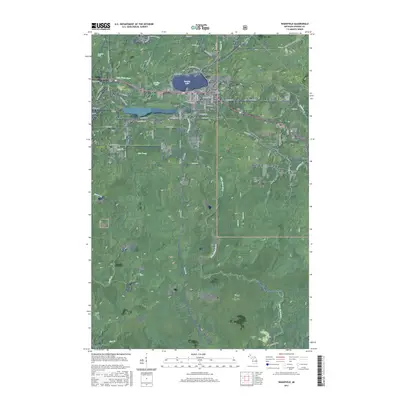
2017 Map of Wakefield
USGS Topo · Published 2017About this map
Wakefield serves as the focal point of this Gogebic County survey, positioned at the southern edge of Sunday Lake. The landscape reflects a legacy of iron mining and timber, with residential streets giving way to historical industrial corridors like Plymouth Mine Rd and N Chicago Mine Rd. Beyond the town center, the small settlements of Plymouth, Wico, and Verona indicate the clustered nature of regional development during the heyday of the Gogebic Range. To the north, Neepikon Falls marks the course of the Little Black River as it traverses the wooded terrain. A significant portion of the southeastern quadrangle is occupied by the Ottawa National Forest, where smaller waterways like Cim Creek and Sunset Cr thread through the protected acreage, illustrating the balance between Michigan's industrial history and its conserved wilderness.
Find a feature on this map
72 named features on this map. Tap any name to fly to it.
Don’t see what you’re looking for? This feature index may not catch every label — zoom into the map to look around manually.
Map Details
Editions of this 2017 Wakefield Map
This is the sole edition of this map. No revisions or reprints were ever made.
Other maps of this area

1943 · Ironwood
USGS Topo · 1:48,000

1953 · Ashland
USGS Topo · 1:250,000

1955 · Bessemer
USGS Topo · 1:24,000

1955 · Wakefield
USGS Topo · 1:24,000

1955 · Wakefield
USGS Topo · 1:62,500

1955 · Wakefield NE
USGS Topo · 1:24,000

1955 · Ironwood
USGS Topo · 1:62,500

1956 · North Ironwood
USGS Topo · 1:62,500

1956 · Thomaston
USGS Topo · 1:62,500

1958 · Ashland
USGS Topo · 1:250,000