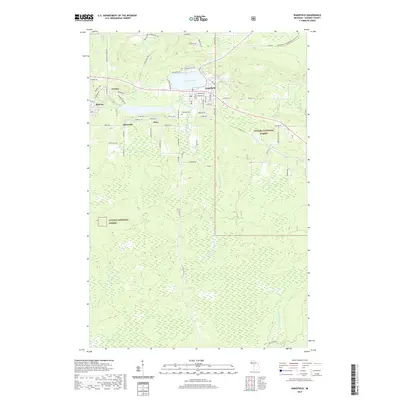
2019 Map of Wakefield
USGS Topo · Published 2019About this map
Wakefield sits at the center of this Gogebic County landscape, where the waters of Sunday Lake meet the Little Black River. The area's industrial legacy is etched into the road network, with names like Chicago Mine Rd and Plymouth Mine Rd tracing the paths of former iron operations. Small residential clusters like Verona, Ramsay, and Wico surround the main settlement, reflecting the distributed nature of early mining-era communities.
Find a feature on this map
75 named features on this map. Tap any name to fly to it.
Don’t see what you’re looking for? This feature index may not catch every label — zoom into the map to look around manually.
Map Details
Editions of this 2019 Wakefield Map
This is the sole edition of this map. No revisions or reprints were ever made.
Other maps of this area

1943 · Ironwood
USGS Topo · 1:48,000

1953 · Ashland
USGS Topo · 1:250,000

1955 · Bessemer
USGS Topo · 1:24,000

1955 · Wakefield
USGS Topo · 1:24,000

1955 · Wakefield
USGS Topo · 1:62,500

1955 · Wakefield NE
USGS Topo · 1:24,000

1955 · Ironwood
USGS Topo · 1:62,500

1956 · North Ironwood
USGS Topo · 1:62,500

1956 · Thomaston
USGS Topo · 1:62,500

1958 · Ashland
USGS Topo · 1:250,000