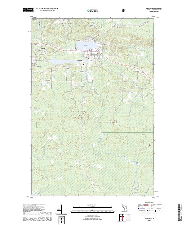
2023 Map of Wakefield
USGS Topo · Published 2023About this map
Wakefield sits at the heart of the Gogebic Range, where the local landscape and street grid reflect a deep-rooted industrial heritage in Michigan's Upper Peninsula. North of the town center, Sunday Lake is flanked by N Chicago Mine Rd and Chicago Mine Rd, while to the southwest, Plymouth Mine Rd serves the settlements of Plymouth and Ramsay. This 2023 survey documents a network of smaller communities including Verona and Wico, all positioned along the drainage of the Black River and its various tributaries like McVichie Creek and Devils Creek. Much of the eastern and southern portion of the quadrangle is occupied by the Ottawa National Forest, a terrain of dense woodlands and winding waterways such as Rice Creek and Jackson Creek. The map provides a contemporary look at the local infrastructure, from the Lakeside Cem to the regional snowmobile trails that traverse the hills north of M 28.
Find a feature on this map
85 named features on this map. Tap any name to fly to it.
Don’t see what you’re looking for? This feature index may not catch every label — zoom into the map to look around manually.
Map Details
Editions of this 2023 Wakefield Map
This is the sole edition of this map. No revisions or reprints were ever made.
Other maps of this area

1943 · Ironwood
USGS Topo · 1:48,000

1953 · Ashland
USGS Topo · 1:250,000

1955 · Bessemer
USGS Topo · 1:24,000

1955 · Wakefield
USGS Topo · 1:24,000

1955 · Wakefield
USGS Topo · 1:62,500

1955 · Wakefield NE
USGS Topo · 1:24,000

1955 · Ironwood
USGS Topo · 1:62,500

1956 · North Ironwood
USGS Topo · 1:62,500

1956 · Thomaston
USGS Topo · 1:62,500

1958 · Ashland
USGS Topo · 1:250,000