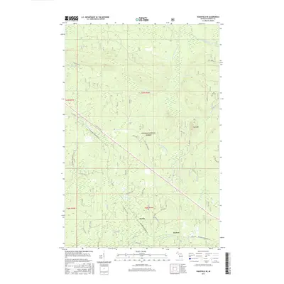
2017 Map of Wakefield NE
USGS Topo · Published 2017About this map
The Ottawa National Forest dominates this section of the Upper Peninsula, where the rugged drainages of the Little Presque Isle River and the Presque Isle River carve through the timberland. Small settlements like Hartley and Dunham are situated along the southern edge of the map, connected by the local corridor of Dunham Rd. The terrain is defined by significant elevations such as Wolf Mtn, which serves as a prominent landmark overlooking several smaller tributaries including Wolf Mountain Cr and Monarch Cr.
Find a feature on this map
26 named features on this map. Tap any name to fly to it.
Don’t see what you’re looking for? This feature index may not catch every label — zoom into the map to look around manually.
Map Details
Editions of this 2017 Wakefield NE Map
This is the sole edition of this map. No revisions or reprints were ever made.
Other maps of this area

1955 · Marenisco
USGS Topo · 1:62,500

1955 · Marenisco
USGS Topo · 1:24,000

1955 · Wakefield
USGS Topo · 1:24,000

1955 · Wakefield
USGS Topo · 1:62,500

1955 · Wakefield NE
USGS Topo · 1:24,000

1956 · Bergland
USGS Topo · 1:62,500

1956 · Thomaston
USGS Topo · 1:62,500

1958 · Iron River
USGS Topo · 1:250,000

1960 · Iron River
USGS Topo · 1:250,000

1961 · Iron River
USGS Topo · 1:250,000