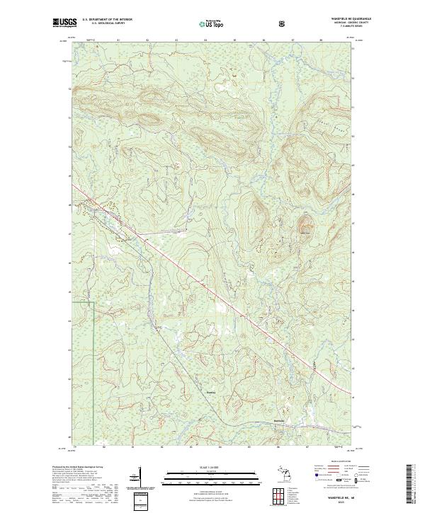
2023 Map of Wakefield NE
USGS Topo · Published 2023About this map
Wolf Mtn and the elevations of the Gogebic Range dominate this corner of the Upper Peninsula, where dense woodlands are preserved within the Ottawa National Forest. The landscape is defined by the complex drainage of the Little Presque Isle River and its numerous tributaries like Brotherton Creek and Emperor Creek. Human presence is concentrated along a handful of corridors, including the path of Old US Hwy 2 and the Bessemer Snowmobile #2 Trl. Small points of settlement such as Hartley and Dunham appear along these transit lines, while the name Morgan Mine Rd hints at the region's long-standing industrial history. The transition from industrial infrastructure like Dump Rd to the undisturbed stretches of the Presque Isle River highlights the dual character of this Northwoods territory.
Find a feature on this map
25 named features on this map. Tap any name to fly to it.
Don’t see what you’re looking for? This feature index may not catch every label — zoom into the map to look around manually.
Map Details
Editions of this 2023 Wakefield NE Map
This is the sole edition of this map. No revisions or reprints were ever made.
Other maps of this area

1955 · Marenisco
USGS Topo · 1:62,500

1955 · Marenisco
USGS Topo · 1:24,000

1955 · Wakefield
USGS Topo · 1:24,000

1955 · Wakefield
USGS Topo · 1:62,500

1955 · Wakefield NE
USGS Topo · 1:24,000

1956 · Bergland
USGS Topo · 1:62,500

1956 · Thomaston
USGS Topo · 1:62,500

1958 · Iron River
USGS Topo · 1:250,000

1960 · Iron River
USGS Topo · 1:250,000

1961 · Iron River
USGS Topo · 1:250,000