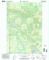
1999 Map of Wakefield NE
USGS Topo · Published 2004About this map
The Ottawa National Forest dominates this landscape in the Upper Peninsula, encompassing portions of the Wakefield, Marenisco, and Bessemer districts. The Presque Isle River and its various tributaries, including the Little Presque Isle River, Jackson Creek, and Alward Creek, create a dense hydrological network throughout the timberland. High ground is marked by Wolf Mountain, which features the Wolf Mountain Trail leading to a designated Vista.
Find a feature on this map
25 named features on this map. Tap any name to fly to it.
Don’t see what you’re looking for? This feature index may not catch every label — zoom into the map to look around manually.
Map Details
Editions of this 1999 Wakefield NE Map
This is the sole edition of this map. No revisions or reprints were ever made.
Other maps of this area

1955 · Marenisco
USGS Topo · 1:62,500

1955 · Marenisco
USGS Topo · 1:24,000

1955 · Wakefield
USGS Topo · 1:24,000

1955 · Wakefield
USGS Topo · 1:62,500

1955 · Wakefield NE
USGS Topo · 1:24,000

1956 · Bergland
USGS Topo · 1:62,500

1956 · Thomaston
USGS Topo · 1:62,500

1958 · Iron River
USGS Topo · 1:250,000

1960 · Iron River
USGS Topo · 1:250,000

1961 · Iron River
USGS Topo · 1:250,000
Featured Places
- Wakefield Township, MI
- Marenisco Township, MI
- Hartley, Marenisco Township
- Dunham, Marenisco Township
- Bessemer Township, MI