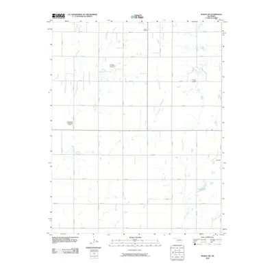
2009 Map of Wakita SW
USGS Topo · Published 2009About this map
The Cherokita Trend Oil and Gas Field and Cherry Vale Oil and Gas Field define the economic landscape of this Grant County region, reflecting the long-standing importance of petroleum extraction in northern Oklahoma. This survey shows a strictly organized section-line road network, including Trenton Rd, which overlays a drainage system of meandering prairie streams.
Find a feature on this map
28 named features on this map. Tap any name to fly to it.
Don’t see what you’re looking for? This feature index may not catch every label — zoom into the map to look around manually.
Map Details
Editions of this 2009 Wakita SW Map
This is the sole edition of this map. No revisions or reprints were ever made.
Other maps of this area

1955 · Enid
USGS Topo · 1:250,000

1955 · Woodward
USGS Topo · 1:250,000

1958 · Enid
USGS Topo · 1:250,000

1958 · Woodward
USGS Topo · 1:250,000

1968 · Wakita
USGS Topo · 1:24,000

1968 · Wakita SE
USGS Topo · 1:24,000

1968 · Pond Creek
USGS Topo · 1:24,000

1968 · Pond Creek NW
USGS Topo · 1:24,000
1968 · Wakita NE
USGS Topo · 1:24,000

1968 · Wakita SW
USGS Topo · 1:24,000