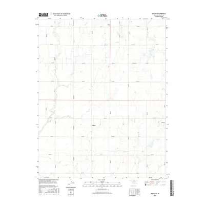
2016 Map of Wakita SW
USGS Topo · Published 2016About this map
Gilbert occupies a central position in this Grant County landscape, serving as a focal point for a vast grid of section roads that define northern Oklahoma's agricultural character. This 2016 survey documents the enduring spatial organization of the prairie, where local travel is facilitated by named routes like Jefferson Rd and Trenton Rd. The natural drainage of the land is shaped by several waterways, including Duel Cr and Lynch Cr, which meander through the rectilinear landscape. To the northeast, the Wakita Cem provides a genealogical touchstone for the area, while the topography is punctuated by Red Hill and the distinct water bodies of Three Lakes in the southeast. This map captures the intersection of natural hydrology and the rigid section-line development typical of the southern Great Plains.
Find a feature on this map
32 named features on this map. Tap any name to fly to it.
Don’t see what you’re looking for? This feature index may not catch every label — zoom into the map to look around manually.
Map Details
Editions of this 2016 Wakita SW Map
This is the sole edition of this map. No revisions or reprints were ever made.
Other maps of this area

1955 · Enid
USGS Topo · 1:250,000

1955 · Woodward
USGS Topo · 1:250,000

1958 · Enid
USGS Topo · 1:250,000

1958 · Woodward
USGS Topo · 1:250,000

1968 · Wakita
USGS Topo · 1:24,000

1968 · Wakita SE
USGS Topo · 1:24,000

1968 · Pond Creek
USGS Topo · 1:24,000

1968 · Pond Creek NW
USGS Topo · 1:24,000
1968 · Wakita NE
USGS Topo · 1:24,000

1968 · Wakita SW
USGS Topo · 1:24,000