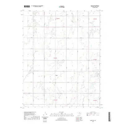
2018 Map of Wakita SW
USGS Topo · Published 2018About this map
Gilbert occupies the center of this rural Grant County landscape, where the flat plains of northern Oklahoma are etched by a network of seasonal watercourses. The drainage patterns of Duel Cr, Lynch Cr, and Spring Cr create subtle topography across the township divisions, leading toward the distinct formation of Red Hill and the catchment at Three Lakes in the southeast. This 2018 survey illustrates the persistent section-line road grid that defines the region, with named routes like Johnston Rd and Jefferson Rd serving scattered farmsteads. Near the northern boundary, the Wakita Cem serves as a significant landmark for genealogical research, anchoring the local history of the surrounding township.
Find a feature on this map
39 named features on this map. Tap any name to fly to it.
Don’t see what you’re looking for? This feature index may not catch every label — zoom into the map to look around manually.
Map Details
Editions of this 2018 Wakita SW Map
This is the sole edition of this map. No revisions or reprints were ever made.
Other maps of this area

1955 · Enid
USGS Topo · 1:250,000

1955 · Woodward
USGS Topo · 1:250,000

1958 · Enid
USGS Topo · 1:250,000

1958 · Woodward
USGS Topo · 1:250,000

1968 · Wakita
USGS Topo · 1:24,000

1968 · Wakita SE
USGS Topo · 1:24,000

1968 · Pond Creek
USGS Topo · 1:24,000

1968 · Pond Creek NW
USGS Topo · 1:24,000
1968 · Wakita NE
USGS Topo · 1:24,000

1968 · Wakita SW
USGS Topo · 1:24,000