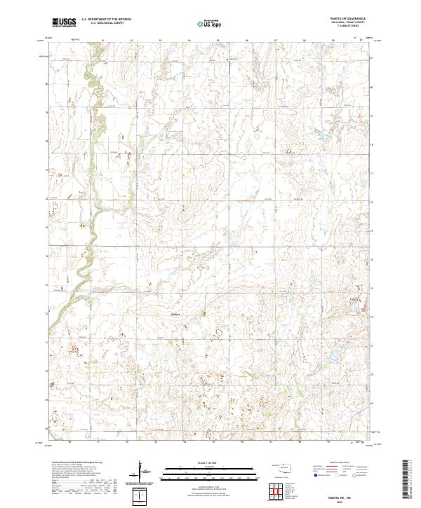
2022 Map of Wakita SW
USGS Topo · Published 2022About this map
Agricultural lands and intermittent prairie drainages define this portion of Grant County, where the settlement of Gilbert sits near the center of a grid-iron road network. The landscape is marked by subtle topographical shifts, such as the elevation at Red Hill and the branching waters of Lynch Cr and Duel Cr. These creeks, along with Spring Cr, carve shallow paths through the township sections, eventually leading toward the Three Lakes area in the southeast.
Find a feature on this map
39 named features on this map. Tap any name to fly to it.
Don’t see what you’re looking for? This feature index may not catch every label — zoom into the map to look around manually.
Map Details
Editions of this 2022 Wakita SW Map
This is the sole edition of this map. No revisions or reprints were ever made.
Other maps of this area

1955 · Enid
USGS Topo · 1:250,000

1955 · Woodward
USGS Topo · 1:250,000

1958 · Enid
USGS Topo · 1:250,000

1958 · Woodward
USGS Topo · 1:250,000

1968 · Wakita
USGS Topo · 1:24,000

1968 · Wakita SE
USGS Topo · 1:24,000

1968 · Pond Creek
USGS Topo · 1:24,000

1968 · Pond Creek NW
USGS Topo · 1:24,000
1968 · Wakita NE
USGS Topo · 1:24,000

1968 · Wakita SW
USGS Topo · 1:24,000