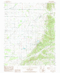
1983 Map of Walcott
USGS Topo · Published 1984About this map
Crowley s Ridge dominates the eastern half of this landscape, creating a sharp topographical contrast with the low-lying agricultural plains to the west. This upland area is anchored by Crowley Ridge State Park, where the terrain transitions from managed woodland into the managed wetlands and irrigation networks of the Delta. Small rural settlements like Walcott, Stanford, and Faulknerville serve as historical nodes for the surrounding farming community, while the presence of a Fish Hatchery near the park indicates a specialized use of the local water resources.
Find a feature on this map
19 named features on this map. Tap any name to fly to it.
Don’t see what you’re looking for? This feature index may not catch every label — zoom into the map to look around manually.
Map Details
Editions of this 1983 Walcott Map
2 editions found
Other maps of this area

1932 · Walnut Ridge
USGS Topo · 1:62,500

1935 · Sedgwick
USGS Topo · 1:62,500

1935 · Walnut Ridge
USGS Topo · 1:62,500

1939 · Jonesboro
USGS Topo · 1:62,500

1940 · Gainesville
USGS Topo · 1:62,500

1953 · Memphis
USGS Topo · 1:250,000

1956 · Memphis
USGS Topo · 1:250,000

1957 · Poplar Bluff
USGS Topo · 1:250,000

1958 · Jonesboro
USGS Topo · 1:62,500

1958 · Gainesville
USGS Topo · 1:62,500