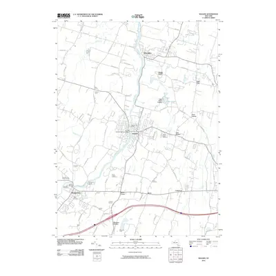
2010 Map of Walden
USGS Topo · Published 2010About this map
The Wallkill River defines the central spine of this Orange County landscape, carving a path through industrial and agricultural communities. In Walden, the river's transit is marked by the Walden Low Bridge and the Walden Veterans Memorial Bridge, reflecting the town's historical reliance on water power and transportation. To the south, the village of Montgomery maintains its core near the Riverside Cemetery and Saint Marys Cemetery, while the presence of the Montgomery Worsted Mills points to a legacy of textile production. The landscape is dotted with generational landmarks such as Hoeffner Farms and Hodgson Farms, alongside the sprawling Maybrook Yards in the south, which highlights the area's role as a regional freight and rail hub. Rural hamlets like Coldenham, Berea, and Saint Elmo are connected by historic routes including the Albany Post Rd, preserving a pattern of settlement that balances agrarian roots with industrial development.
Find a feature on this map
83 named features on this map. Tap any name to fly to it.
Don’t see what you’re looking for? This feature index may not catch every label — zoom into the map to look around manually.
Map Details
Editions of this 2010 Walden Map
This is the sole edition of this map. No revisions or reprints were ever made.
Other maps of this area

1902 · Schunemunk
USGS Topo · 1:62,500

1903 · Newburg
USGS Topo · 1:62,500

1904 · Ellenville
USGS Topo · 1:62,500

1906 · Ellenville
USGS Topo · 1:62,500

1906 · Goshen
USGS Topo · 1:62,500

1908 · Goshen
USGS Topo · 1:62,500

1930 · Schunemunk
USGS Topo · 1:48,000

1935 · Schunemunk
USGS Topo · 1:62,500

1938 · Goshen
USGS Topo · 1:62,500

1942 · Goshen
USGS Topo · 1:24,000