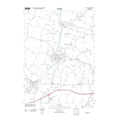
2013 Map of Walden
USGS Topo · Published 2013About this map
The Wallkill River defines the industrial and civic heart of this Orange County landscape, anchoring the village of Walden and the town of Montgomery. In Montgomery, the Montgomery Worsted Mills stands as a significant industrial landmark near Ward's Bridge, while the village of Walden is characterized by its vital crossings, including the Walden Veterans Memorial Bridge and the Walden Low Bridge.
Find a feature on this map
205 named features on this map. Tap any name to fly to it.
Don’t see what you’re looking for? This feature index may not catch every label — zoom into the map to look around manually.
Map Details
Editions of this 2013 Walden Map
This is the sole edition of this map. No revisions or reprints were ever made.
Other maps of this area

1902 · Schunemunk
USGS Topo · 1:62,500

1903 · Newburg
USGS Topo · 1:62,500

1904 · Ellenville
USGS Topo · 1:62,500

1906 · Ellenville
USGS Topo · 1:62,500

1906 · Goshen
USGS Topo · 1:62,500

1908 · Goshen
USGS Topo · 1:62,500

1930 · Schunemunk
USGS Topo · 1:48,000

1935 · Schunemunk
USGS Topo · 1:62,500

1938 · Goshen
USGS Topo · 1:62,500

1942 · Goshen
USGS Topo · 1:24,000