2023 Map of Walden
USGS Topo · Published 2023About this map
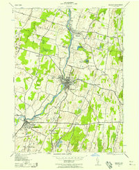
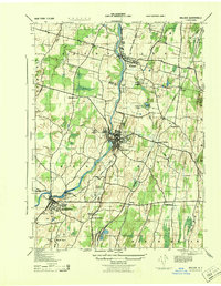
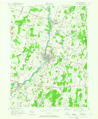
The Wallkill River flows northward through this modern topographic survey, anchoring a landscape where historic village centers and agricultural tracts meet contemporary residential growth. In the village of Walden, the river is joined by Tin Brook, while to the south, the village of Montgomery sits near the winding Muddy Kill. For genealogists and local historians, the map is remarkably dense with burial grounds, including the Old Brick Church Cem, Saint Marys Cem, and the Goodwill Presbyterian Church Cem near Scotts Corner. The northern portion of the sheet features the Borden Estate and Lake Osiris Colony, highlighting the area's legacy of large landholdings and seasonal communities. Extensive wetlands like the Great Swamp and prominent water bodies such as Orange Lake and the Maybrook Reservoir define the lowland drainage patterns of the Wallkill Valley.
Find a feature on this map
194 named features on this map. Tap any name to fly to it.
Don’t see what you’re looking for? This feature index may not catch every label — zoom into the map to look around manually.
Map Details
Editions of this 2023 Walden Map
This is the sole edition of this map. No revisions or reprints were ever made.
Historical Maps of Maybrook Through Time
4 maps found