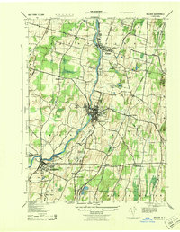
1943 Map of Walden
USGS Topo · Published 1943About this map
The Wallkill River defines the central corridor of this Orange County landscape during the early 1940s, serving as the industrial and geographic anchor for the villages of Walden and Montgomery. The region's agricultural and industrial heritage is evident in the presence of the Borden Dairy Farm and Borden Estate near Wallkill, reflecting the legacy of the prominent condensed milk company. Connectivity is provided by the Wallkill Valley Branch and New York Central railroads, which linked these rural communities to broader markets.
Find a feature on this map
36 named features on this map. Tap any name to fly to it.
Don’t see what you’re looking for? This feature index may not catch every label — zoom into the map to look around manually.
Map Details
Editions of this 1943 Walden Map
This is the sole edition of this map. No revisions or reprints were ever made.
Other maps of this area

1902 · Schunemunk
USGS Topo · 1:62,500

1903 · Newburg
USGS Topo · 1:62,500

1904 · Ellenville
USGS Topo · 1:62,500

1906 · Ellenville
USGS Topo · 1:62,500

1906 · Goshen
USGS Topo · 1:62,500

1908 · Goshen
USGS Topo · 1:62,500

1930 · Schunemunk
USGS Topo · 1:48,000

1935 · Schunemunk
USGS Topo · 1:62,500

1938 · Goshen
USGS Topo · 1:62,500

1942 · Goshen
USGS Topo · 1:24,000