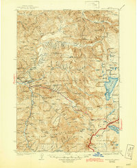
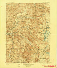
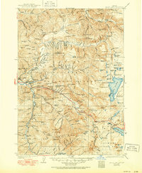
1925 Map of Waldo Lake
USGS Topo · Published 1944About this map
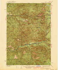
Oakridge sits at the western edge of this 1923 survey, serving as a gateway to the high Cascades where the Southern Pacific railroad and the Willamette Highway follow the river corridors. The landscape is dominated by the sprawling waters of Waldo Lake and Odell Lake, surrounded by a dense network of forest service infrastructure including the Cottonwood Springs Ranger Sta and the State Fish Hatchery.
Find a feature on this map
207 named features on this map. Tap any name to fly to it.
Don’t see what you’re looking for? This feature index may not catch every label — zoom into the map to look around manually.
Map Details
Editions of this 1925 Waldo Lake Map
4 editions found
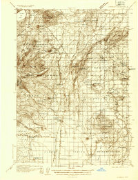
Other maps of this area

1917 · Diamond Lake
USGS Topo · 1:125,000

1925 · Waldo Lake
USGS Topo · 1:125,000

1929 · Three Sisters
USGS Topo · 1:125,000

1930 · Maiden Peak
USGS Topo · 1:125,000

1932 · Three Sisters
USGS Topo · 1:125,000

1934 · Maiden Peak
USGS Topo · 1:125,000

1934 · Mc Kenzie Bridge
USGS Topo · 1:96,000

1935 · Lowell
USGS Topo · 1:96,000
1935 · Chemult
USGS Topo · 1:96,000
1940 · Mc Kenzie Bridge
USGS Topo · 1:125,000