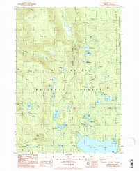
1986 Map of Waldo Mountain
USGS Topo · Published 1986About this map
Waldo Mtn and the surrounding Willamette National Forest dominate this mid-1980s landscape, defined by a dense network of high-elevation lakes and the headwaters of the Middle Fork Willamette River. The map captures a transition point in forest management and recreation, featuring the Taylor Burn Forest Service Sta and several established lakeside sites like Skookum Campground and Islet Campground. The abundance of water bodies, from the larger Lake Chetlo to the Erma Bell Lake chain, illustrates the glacial-carved hydrology of the Cascade Range. To the east, the boundary of the Three Sisters Wilderness marks a shift toward more protected terrain, while a Gaging Station and various forest trails indicate the ongoing monitoring and accessibility of these uplands.
Find a feature on this map
55 named features on this map. Tap any name to fly to it.
Don’t see what you’re looking for? This feature index may not catch every label — zoom into the map to look around manually.
Map Details
Editions of this 1986 Waldo Mountain Map
This is the sole edition of this map. No revisions or reprints were ever made.
Other maps of this area

1925 · Waldo Lake
USGS Topo · 1:125,000

1930 · Maiden Peak
USGS Topo · 1:125,000

1934 · Maiden Peak
USGS Topo · 1:125,000

1955 · Chucksney Mtn
USGS Topo · 1:62,500

1955 · Crescent
USGS Topo · 1:250,000

1956 · Waldo Lake
USGS Topo · 1:62,500

1957 · Crescent
USGS Topo · 1:250,000

1958 · Crescent
USGS Topo · 1:250,000

1958 · Roseburg
USGS Topo · 1:250,000

1959 · Roseburg
USGS Topo · 1:250,000