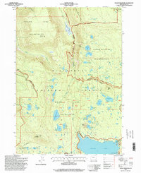
1997 Map of Waldo Mountain
USGS Topo · Published 1998About this map
Waldo Mountain and Moolack Mountain anchor this high-elevation landscape within the Willamette National Forest. At the time of this late-1990s survey, the area is defined by the intersection of the Waldo Lake Wilderness and Three Sisters Wilderness, protecting a dense network of alpine lakes and glacial terrain. The map records a significant concentration of water bodies, including the tiered Lower Erma Bell Lake, Middle Erma Bell Lake, and Upper Erma Bell Lake. Cultural markers are sparse but specific, such as the Gaging Station and Boat Ramp at the northern tip of Waldo Lake. Unique features like the Taylor Burn suggest the history of fire in these woods, while place names like Claire Prairie and Waldo Meadows highlight the diverse subalpine ecosystems found between the steep ridges of Fisher Creek and Moolack Creek.
Find a feature on this map
63 named features on this map. Tap any name to fly to it.
Don’t see what you’re looking for? This feature index may not catch every label — zoom into the map to look around manually.
Map Details
Editions of this 1997 Waldo Mountain Map
This is the sole edition of this map. No revisions or reprints were ever made.
Other maps of this area

1925 · Waldo Lake
USGS Topo · 1:125,000

1930 · Maiden Peak
USGS Topo · 1:125,000

1934 · Maiden Peak
USGS Topo · 1:125,000

1955 · Chucksney Mtn
USGS Topo · 1:62,500

1955 · Crescent
USGS Topo · 1:250,000

1956 · Waldo Lake
USGS Topo · 1:62,500

1957 · Crescent
USGS Topo · 1:250,000

1958 · Crescent
USGS Topo · 1:250,000

1958 · Roseburg
USGS Topo · 1:250,000

1959 · Roseburg
USGS Topo · 1:250,000