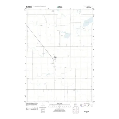
2010 Map of Waldorf
USGS Topo · Published 2010About this map
Waldorf serves as the primary hub of this southern Minnesota landscape, situated at the intersection of a diagonal rail line and County Hwy 32. The village is centered around the Waldorf Post Office, with the First Lutheran Church Cemetery located just to the south along the Little Cobb River. This 2010 survey reveals a high density of rural burial sites, including the Freedom Lutheran Church Cemetery and Freedom Cemetery in the north, and Vivian Cemetery further east. These sites, alongside family-named landmarks like Radloff Cemetery and Hendrickson Cemetery, provide significant data for genealogists tracing local lineage. The topography is defined by the winding paths of Bull Run Creek and the drainage into Silver Lake, where the Silver Lake Dam regulates the water level in the northeast corner of the quadrangle.
Find a feature on this map
36 named features on this map. Tap any name to fly to it.
Don’t see what you’re looking for? This feature index may not catch every label — zoom into the map to look around manually.
Map Details
Editions of this 2010 Waldorf Map
This is the sole edition of this map. No revisions or reprints were ever made.
Other maps of this area

1950 · Mankato East
USGS Topo · 1:62,500

1951 · Mankato East
USGS Topo · 1:62,500

1953 · Saint Paul
USGS Topo · 1:250,000

1954 · Mason City
USGS Topo · 1:250,000

1957 · Mason City
USGS Topo · 1:250,000

1958 · Mason City
USGS Topo · 1:250,000

1959 · Saint Paul
USGS Topo · 1:250,000

1966 · Waseca
USGS Topo · 1:24,000

1966 · Janesville
USGS Topo · 1:24,000

1967 · Minnesota Lake
USGS Topo · 1:24,000